Northtour - Norway (7)

From Skitbotn I took the way to Tromsö which lies on a small island. The traffic routing over there was inconvenient - before I could think about where I was located I was in the inner city. While driving through I landed in a residental district and on that street I reached a center for what evver. And the street was dead-end. So I was looking for a way out, found a small not signed road and cribbed back somewhere to the right way. By the way I have had technical problemes with my old navigation system and meanwhile the display was no more readable. May be that I took the wrong way because of this.
At the end of the 862 in Brensholmen the ferry was waiting and I could take it. Than I had a quiet passage to Botnhamn.
Here in this fissured island- and fjord-world you have to decide which road to take, when you have left the ferry. One solution is to drive the Atlantic Ocean site oder along the fjords. The second idea I decided for.
I drove to Finnsnes (86) and Sörreisa (84), turned right to the FV211 and further on the right to the 848 to get to the islands Andörja and Rolla. Unfortunetaly it was a bit rainy and partly drops betted on the linse of the action-cam. Reindeer was to be seen; you'll find them at minute 04:00 in the next video. Many bridges were to cross. Another interesting passage can be found at minute 06.00.
Last but not least the road began to narrowing and to get worse.
 My next ferry should have been going fraom Sörollnes but I found a jetty before where some people waited. But this was Breivoll. No, that cound't be the right location, that was clear to me. So I went on. There also were no signs or explanationes that the road was closed because of an landslide. I was wondering because no one crossed my way until I came to the place where the street was buried.
Now it was clear why I always had to read of the ferry in Breivol. That was at the jetty I had seen before. However the ferry was again - a thing I have had sometimes in my journey. Normally that would not have been any problem to me. I had the tent with me. But try to find a place for the tent at a small street which on the one side lies directly a a hill and on the other side is going straight down to the water. And it should be away from the street about 20m and in addition it shouldn't be seen of a hous with less than 200m distance. Such a place was not to be found around there.
So I drove back from the point of landslide to find a place I could take for the night. With a bit luck I found a location but it was directly at the street. But who would come hier while the road was closed 3km ahead? No one came.
It was after 10:30 p. m. and the sky was still light. Yes, I was north of the Polar Circle.
The data to day 13 (2018, May 22th):
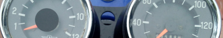
Km-Stand (mileage): 52.548km, 368km (229 miles) driven
Refuel: 385km, 18.34L, 314NOK = 32.93€
Overnight stay: -
Ferry: Botnhamn 136NOK = 13.12€
Eating, drinking: 260NOK = 27.97€")